Sunday 27 December 2009

11th day (A Stroll In The Woods)

Merry x-mas.
It's a sign that we're moving forward when the Seggafreddo at Kedarim is not a stopping point on the way to the start of a leg. Today we met in a different petrol station in a different area. We didn't even check if we could get coffee there. We didn't know it then but we really didn't need to hurry.
There was some doubt whether we were going get to walk today as Garry was carrying a basketball injury from earlier in the week. He actually tripped over the basketball and fell onto it, hurting his ribs. Bet Michael Jordan never managed that! So as long as he didn't laugh, sneeze or jump then he'd be ok. Sneezing we can't control, it was an easy walk that didn't demand any commando style jumping, but we usually do have a good laugh.
From Tzomet Hamovil (Hamovil Jct.) we drove on to the village of Mash'had and met up with Tracey who decided that she could put up with us once more, or maybe we'd decided that we could put up with her once more . Perhaps she just couldn't resist the animal magnetism of 3 middle aged men in various stages of over-weightness and baldness, or simply she was just so bored that even a day with us looks like a good time. At any rate, it was nice to have her along again.
Since we all live in the Galil and going through an Arab village is about as interesting and exciting as watching grass grow, we decided to drive through Mash'had and start walking when the village gives way to forest. Having said that, Mash'had is much cleaner and well kept than the run down villages in our immediate vicinity, but as Yoni pointed out, that really isn't very hard. I was of the opinion that the village was still part of the shvil so we could have walked at least through part of it but I was outvoted 3 to 1.
So once again we parked the car in an ad hoc garbage dump that seems to be at the edge of every Arab village, rolled our eyes, clicked our tongues , crinkled our noses at this offence to our western sensibility, and set off. The village ended in a very pretty pine forest that unfortunately wasn't spared the cultural view that garbage can be dumped anywhere that isn't in my house, but after a few minutes it was just us and nature.
This pine forest  descended into a small valley that we would walk through for the next while. Very pastoral. A lush green valley surrounded by forest, the houses of the community settlement of Hoshi'a on one side of the valley and at the mouth of the valley some distant hills. It goes without saying that there were, of course, cows feeding in this meadow. We passed the back gate of Hoshi'a, turned left and walked towards the settlement of Tzippori. Modern day Tzippori sits adjacent to the ruins of the ancient city of Tzippori, seat of the Sanhedrin. This site is so important to the history of the Jewish people in Israel that the education ministry dictates that every Jewish school pupil must visit the site at some point in his schooling.  Since we finished school a few years ago already and the path doesn't actually go through the historical site and I think we have all been at some point to the very impressive ruins, we didn't go in. The shvil did however go past the grave of the Rabbi Yehuda HaNassi, one of the more important figures of that period.
We'd been walking for all of an hour and a bit when we felt that our sandwiches were weighing our bags down so we stopped to have some of Garry's herbal tea, croissants and sandwiches. Ahh, it's a hard life, but someone's gotta do it. Now that we were rested and the food was weighing our stomachs rather than our bags down we re-started up a hill. A hill, not a mountain like the previous walk. A bit steep, but even Yoni and his new-found whinging partner didn't complain too much. If truth be said, I think Yoni led the charge up the hill. A first time for everything.
And so we ambled on. When we weren't walking through forest we walked through open meadows, the grass wet with morning dew, which in turn soaked our feet but left the rest dry. It appears that we weren't the first ones to notice that this leg is a very relaxed one, after the Swiss Alps that we negotiated last time. Even the shvil maker had his shabbat day off today. There were places where the way was so obvious that they didn't really make a path to follow. Sort of "get to the other end of the field and you'll know where to go". A marking here and there. In the beginning of the walk the shvil marker must have left his blue paint at home because we had white and orange markings without the blue. This continued on while the shvil marker's assistant ran home to find the blue paint he'd forgotten under his bed. Eventually he got back with the blue paint, but in keeping with today's easy going attitude, he didn't go back and repaint the bits that were just orange and white. If the shvil painter and his assistant had been Australian they probably would have said something like "no worries, mate".
The forest changed from K.K.L planted pine forests to natural oak. Actually there's a plague that's killing off the conifers in the Middle East. It started in Turkey and has spread through Lebanon and is making its way south through Israel. It was quite evident today. Patches of pines and cedars that were dead or dying. For Israel it's not actually such a bad thing. The J.N.F planted lots of these trees in the past because they're hardy and quick growing but they prevent the regrowth of the natural oak. If the planted pines die off this will allow the natural forest to grow back.
So after a little more than 2 hours of easy relaxed walking on a superb sunny winter's day, through green valleys, open meadows and forests, we found the petrol station where the car was parked. We decide to leave the marked shvil path and make our way directly to the petrol station. This was all fine and good but it meant us having to negotiate a couple of barbed wire fences. Remember, Yoni and barbed wire don't go together, or more correctly, go together too much. Finally, after all these years of walking, Yoni seems to be getting the hang of getting through barbed wire unscathed.
The only question left to answer was would El-tanur be open this early? Remember last time this gourmet Arab restaurant  was closed for the Muslim holiday of Id-el-Atchah. On the Christian holiday of Christmas there was no such problem. The salads, local wild greens, and most importantly stuffed lamb shoulder was there waiting for us when we got there.
P.S. A word about the book. Over the course of these past 10 months there have been a few times when I've doubted the authenticity or reliability of the book. Today just takes the cake. Today's leg is stated as 13 km. We drove about 2 km through Mash'had, leaving 11 km of walking. We tend to walk quite quickly but not so quickly that we can cover 11 km in 2 1/2 hours. The last leg was rated as of medium difficulty, including the first part straight up Mt. Tabor which we didn't do. Perhaps if you're a 21 year old who just finished the army then it may be a medium difficulty walk. But here's the rub. Today's walk was also rated as medium difficulty. My 91 year old grandmother wouldn't have found this a medium difficulty walk, barring perhaps the one hill that Yoni ran up. This leads me to the conclusion that the author of the book wrote it from the comfort of his study, aided by an old 1:50,000 contour and path map and skilled use of Google Earth.


Monday 30 November 2009

10th day (Mountain Walking)


7a.m.,Garry, Seggafreddo, Yoni, park a car at the end, drive other car to the start. As usual.

This time the start was atop Mount Tabor. The drive up is far scarier than anything we've had to walk so far on the trail. A  road so narrow that it should be one way but is indeed two way, with tour buses loaded with Nigerian pilgrims and local Bedouin daredevils going in both directions on both "sides" of the road. Read "any available direction and side of the road".  The narrowness wouldn't have been such a problem if the slope had been slightly more gradual and the countless switchbacks less sharp. Still, we drove up and down the mountain without mishap and with a feeling of driving the Alps right here in Israel. The Nigerian pilgrims were coming up the hill to visit the monastery at the top which has some holy significance related to a bloke that walked these same mountains that we were going to walk today, some 2000 years ago. In fact apparently there is a three or four day route of walks in the area that goes between Mt. Tabor, Nazareth and the Sea of Galilee that retrace Jesus' footsteps. The tourism ministry markets it to religious Christians that want to combine proximity to holy sites and being close to nature in the holy land. Another way for the Yids to take some cash off the Goys. I think its called "the Jesus route" but I'm going to call it shvil Jesus and I think today's leg of shvil yisrael coincides with shvil Jesus. I can't say for sure because we didn't meet another soul on the path today, not regular shvillers and not messianic Christians. It's getting late into the all-in-one-go shvill season, the many shvillers that we saw last time having already migrated south to the Negev  for the winter.
I may have a photo of a shvil Jesus marking, I may not. The few photos that we did get of this leg were courtesy of the camera on Garry's cell-phone. I did bring a camera but it had been disabled by our house pixies. How many people know of this phenomena where in a house that has kids under, say, 15, and specifically twins in the 12 year old bracket, things just get magically broken or go missing? When a parent has the gall to ask if anyone has any idea how the memory stick happened not to be in the camera, you get a look that is a mixture of indignation and angelic innocence, accompanied by a smart-arse reply of "well why didn't you check before you took it?" The pixies did it. We have very active pixies in our house.

Anyhow, instead of shvillers or Christians, we met up with Tracey on the top of Mt. Tabor, who was joining us for this leg. Those of you from Melbourne reading this blog probably know Tracey. Those that don't, she's an old friend of Garry, Yoni and I back from school days, when the boys would hang out with the girls two years younger. Over the years I've kept in contact with Tracey and when we got to the area that is close to where she lives I invited her along. Its nice having a guest walker. You know after over 30 years and probably close to 100  hours of walks through the Galilee and Umbria Yoni, Garry and I still don't run out of topics of conversation, but a guest walker is a welcome thing.
So the 4 of us set off down the familiar orange blue and white marked path, readying ourselves for a steep descent. This leg actually starts at the base of the mountain and would have us attempt an assault on the summit before descending the path that we were now on. I wanted to climb up from the bottom but the assault would have been on me had I tried to insist. In retrospect it was good that I was unanimously outvoted and we started at the top as by the time we got to the end of today's walk we were all pretty bushed.
We'd been walking a few minutes when something, call it a sixth sense or dumb luck, came to me to ask Yoni, the present Keeper of the Book, to check that we were descending the down path, and not the up path. Sure enough, if we'd continued on this path to the bottom it would have led us to the official start of the leg, the place that the shvil planners would have us climb up from, and nowhere near anywhere we wanted to be. Having wasted no more than 5 minutes and with Lady Luck smiling down on us, we turned around and found the correct down path on our way to Nazareth. One day our luck will run out on us and keys will be lost, or we'll end up miles in the wrong direction, but for the moment all was fine.
. The spectacular views from the top of Mt. Tabor in the direction of Nazareth make it appear as if its a long way to walk and that it entails a pretty steep ascent up a mountain to get there. That is, a steep descent from where we were now into a valley and then the ascent to Nazareth. Our collective eye  left a mountain out of the route.Today we were to descend Mt. Tabor, climb Mt Dvorah, descend Mt Dvorah and then finish it all off with an ascent of Mt. Yonah which is in Nazareth. We didn't account for that extra mountain in between.
After about a half hour or so we got to the bottom. The descent was indeed steep but not difficult, and the walk along  the narrow path through the leafy oak forest in the chill of the morning was one of the sections that makes this 960km shvil yisrael trek so worthwhile. We would have quite a few of these sections today. This path came out at a large bus parking area with the mandatory tourist souvenir shop and the cynic\lazy amongst us commented that we could have parked here and saved the kamikaze drive up and subsequent walk down. I think someone just as cynical replied along the lines that we could find a way to drive the entire route and thus save ourselves all together the need to sweat. Anyhow we continued on, resisting the temptation to but a tee-shirt that said something like "Jesus loves Nigerian pilgrims (and their money) at Mt. Tabor "
We've walked to this point about 120 km and for the first time we were walking through an Arab (Bedouin) village. We had walked through Tiberius Elite (city), Moshavat Kinneret (village), Kibbutz Kinneret (kibbutz) and now we were going through Shibli, a large Bedouin village. We exchanged numerous pleasantries and salutations for a pleasant festival (today was Id-el Adkha, the most important festival in the Muslim calendar. It's based on the same idea as the biblical demand that God made of Abraham to sacrifice Isaac on the alter, but the Muslims claim that God demanded Abraham to sacrifice Ismael. Judaism and Islam have so much in common that sometimes it seems ludicrous that there is so much enmity between the two) and continued on our way
After a kilometre or so we left Shibli, passed through olive groves on the outskirts of the village and soon entered the Beit Keshet forest which we would walk through for the next 6 or 7 km. It became pretty obvious pretty soon that we'd bottomed out and since we were walking across the valley and not along it we wouldn't have much flat time. Sure enough, it didn't take long till we we started to climb. This was, however, for a good distance, the best way to climb. In the shade of beautiful forest, on a perfect autumn day and the slope very gentle. Add to this a good wide comfortable walking track and magnificent views of mountains in front and behind and us in a green valley. If this idyllic picture of heaven on earth wasn't enough , then add the bright green of the grass that is growing everywhere after the early and heavy rains that we've had since our last walk. Amongst the grass, dainty little pink flowers. And white ones. And purple ones (The purple ones are crocus, the others I wouldn't have a clue). We even saw for the very first time some pheasants, or partridge, or some type of almost flightless bird that people with shotguns like to kill in the name of sport. (never understood that one. That's about as much sport as putting me in the ring with Mike Tyson).  Now I'm going to add some cows who look as happy as us to see the green grass (wouldn't you, if you'd been eating mouldy hay for these past 6 months?) to the portrait and there you have it. A good 7 km stretch that reminds us why we're here on the shvil.
Well, it had to end sometime. And end it did. We came out of the forest and almost immediately the grade went up a good few notches. We'd gone from gentle slope to sharp incline very quickly and this was a sign that we had come out of the valley and were now ascending  Mt. Devorah. Whilst we were walking the gentle slope bit we didn't feel its affects too much, mainly due to all the fore-mentioned peripherals distracting our attention. Now we were really having to use our muscles to get up the hill, the previous 7 km of uphill, as easy at it was, started to have its affect. So we huffed and puffed and forgot that a few minutes earlier we had been as serene as the cows we'd walked past. Instead we were cursing the very idea that on our day off we chose to sweat out here in the sun rather than sip macchiato and eat croissant at the local boulangerie, as is becoming of people of our age and status. What, me fickle?
Eventually we did get to the top and it really was quite beautiful. Forest with a thick lush layer of green grass that just beckoned for us to lay down and have a shloof . In the middle of this forest, on top of this mountain was a monument. Not a monument to a particular obscure corps in the army. Not, thankfully, a monument to a fallen soldier or soldiers from a particular war or incursion. Not the visiting Ecuadorian President either. A monument to commemorate the 50th wedding anniversary of Her Royal Highness, Queen Elizabeth the Second and Prince Phil the Greek. I kid you not. Here on top of Mt. Dvorah, between Mt. Tabor and Nazareth. It was adorned with the royal emblem even. If there is a more surreal monument on the rest of shvil yisrael then I'm a hippo's uncle. Somehow we managed to pull ourselves away from the monument and found under a tree in the forest a very inviting picnic table, doubtless donated by the Queen herself. This was the perfect spot to eat our playlunch. Tracey was a good deal more relaxed than us since from previous experience we expected a parks inspector to jump out from behind a tree at any moment and demand payment for the right to sit at the table. Given the circumstances, next to Lizzy and Phil's 50th wedding commemorative monument, perhaps the inspector would have a cockney accent "'scuse me guv, gotta pay 2 quid to use that table" 
After a nice long break we headed off down the path, back towards Yoni's car, civilisation and life. There's no doubt that one of the primary reasons that we've embarked on this adventure is because it is a break from life. It had been almost two months since our last walk because sometimes life just gets in the way of our walks. Its safe to say that we all lead good lives, no complaints (except Yoni's usual complaints about how hard the uphills are. Today Tracey took his role as chief grump)  but these walks once a month are a break from life that put so much into perspective. If more people did it there'd probably be a lot of unemployed therapists out there. 
Enough pop psychology crap. We found ourselves descending very quickly through thick forest until we inevitably bottomed out. That is the nature of the relationship between shvil yisrael and mountains. You walk up a mountain just so you can walk down its other side and then climb another. And there's the rub. We got down to the bottom, looked west and up and saw in the distance the approximate area that we had to get to. And it wasn't close and it was above us. So off we trudged, slowly, along narrow back paths, through old olive fields and almost always on the up. Sometimes the path took a down direction, but this was in no way a relief. Au contrare. It meant that we'd lost precious elevation that we would only have to re-climb. During the earlier parts of today's walk there was lots of conversation. Now we all walked silently, just trying to get one foot after the other and not wanting to waste even a solitary kilojoule of energy on anything else. Occasionally we'd turn around or get to a point where we saw what we'd covered and at the same time saw the Tabor sitting alone in the middle of the Jezreel valley and it was stunning. I might consider using the word "breathtaking" but it was this path and the final push to the car that was taking our breaths at this point. But of course we did eventually get to Yoni's car, very tired and very satisfied. If we needed a jolt back into the real world then here it was. After walking for 5 hours through some of the most untouched and least walked areas that we'd seen, here was the car, parked in a small, unofficial garbage dump, where the butchers of the village of Ein Mahral threw unwanted carcasses. Lovely.
Those that have bothered reading previous blogs will know that the meal at the end, usually humus, is as much a part of the day as panting up hills. Today's leg conveniently finishes right next to one of Israel's best Arab restaurants, named El Tanur . Not  Abu Rami or Malachim, our beloved humus joints in our home area. Not the generic Abu Abu in any Arab town. This is fine Palestinian cuisine and we figured that today we deserved it. Hmpf. I mentioned earlier that today was Id-El Adkah, the Muslim holy day. The restaurant was closed! As we drove down through the town of Cana, everything was closed. Just as we were giving up all hope of finding somewhere to quell our appetite we found the one restaurant in the area open. The Abu Abu humus joint of Cana may not have been gourmet Palestinian cuisine but it just hit the spot all the same.

Saturday 10 October 2009

9th day (Femur)


I had mailed Yoni and Garry during the week, warning them that this leg was going to be a long one. I wasn't wrong. I actually think that this walk turned out to be the longest and hardest we've done to date, but like all our walks, full of different experiences from those that came before and no less enjoyable.
The Shvil planners would have us do this leg from the Yardenit baptismal site at 209 metres below sea level to the base of Mt.Tabor at 153 metres above sea level over a 28 km route. 2nd grade maths allows me to conclude that a 362 metre climb over 28 km for 50 year old bodies just does not compute. So instead we found ourselves doing all our normal stuff...driving the first 3 km on road, splitting the leg into the femur and the tibia and to continue the medical metaphor just once more, starting at the hip and working down towards the foot. Even if we "only" did 18 of the 25 km it was the foot that was sore at the end.
Since we weren't walking the entire leg today, we had to find a suitable place to finish today and then start next time, a place that would allow us access from the road to the walking path. The town of Yavniel is reasonably close to the path but the only track leading from there that crossed our path was labelled on maps as a 4wd track. No problem for Yoni's car but my van is definitely not 4*4. I sent another mail warning that we may get stuck even before we started. Thankfully the track turned out to be in better repair than half the roads in Tel Aviv and we easily arrived at the end point to drop off my van .
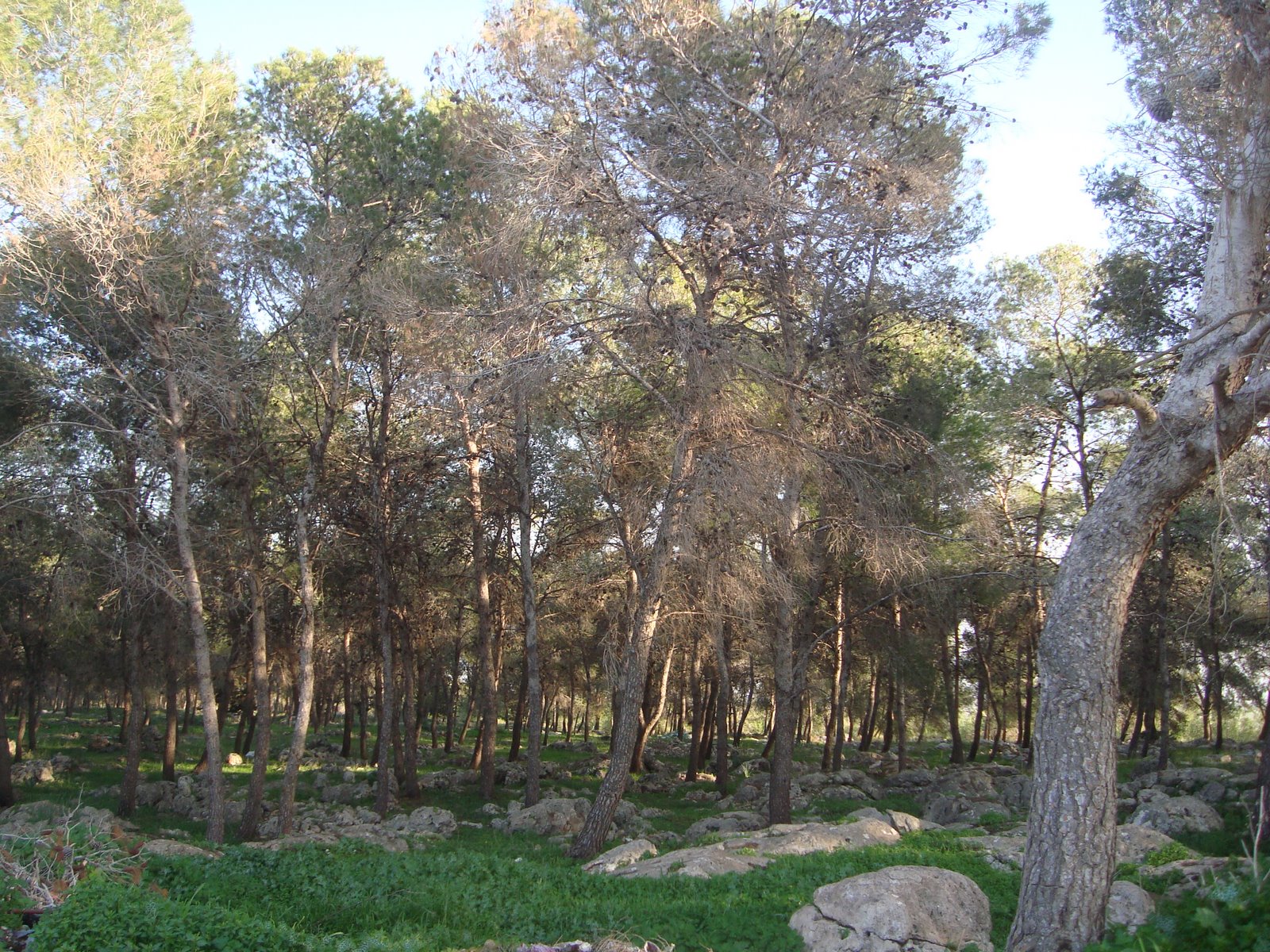
By 7.30 we had done all the beginning and end car parking arrangements and hit the trail. From the beginning we could see that we have moved into a different geographical area. The 100 km that we've walked until now have been through the Upper Galilee and Galilee Heights which is mountainous and forested to varying degrees. Here we were walking through an open expanse of undulating hills separated by shallow dry creek beds, with the Tabor at our backs the entire time. I may describe the topography as "undulating hills", and that's fine when your driving it. Change up a gear and the motor will easily power you up and over. 
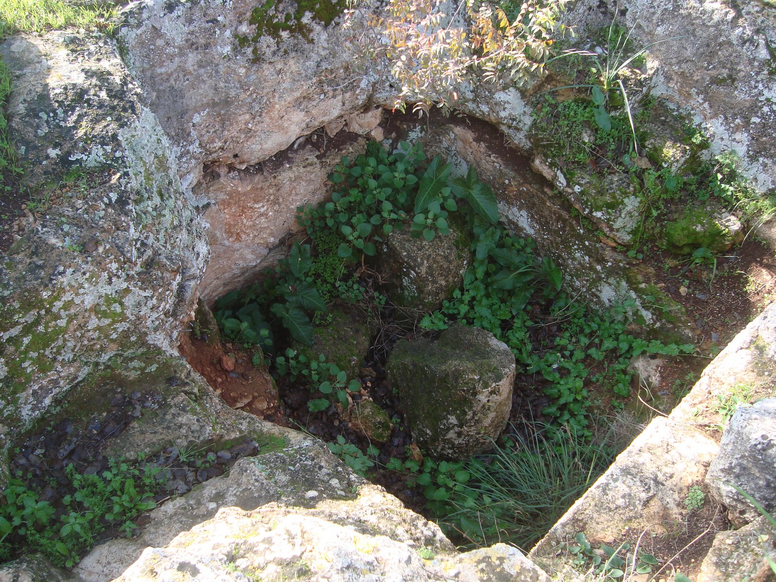
. The ups and downs of "undulating hills" to a walker are not so easily negotiated. The creeks that run between the hills only run in the winter but colour the landscape with thin ribbons of green that indicate the creek's path. In the Upper Galilee the stream beds are deeper and more densely covered. This area is much drier and reminded us that Israel, apart from the mountainous north, is largely a desert country. And we're no where near the Negev yet. Still, the landscape was quite pretty; a large earth-brown area ribboned by the green strips of creeks beds. As we walked further we occasionally turned back to see the views behind us, with the ever present but shrinking Tabor on the horizon.
Now this is all well and good for the first kilometre, two kilometres , three. As you approach your tenth or twelfth kilometre it gradually doesn't seem so pretty and each hill you have to climb seems like a mountain. Since it was my decision to walk in this direction I had to justify myself to my whinging friends, explaining that we would eventually get to a lip where we would start to drop very sharply. If we'd done it in the other direction we would have to climb a long and very steep path and then go up and down these same hills. Of course when you go up a number of hills you sometimes overlook the fact that each uphill is connected to a downhill and it appears that your only walking up the hills for a long time. Eventually we did get to the lip and when my walking partners saw and then walked the big downhill slope they begrudgingly admitted that perhaps I had chosen the correct direction. Did I mention the word begrudging? Or as Garry put it, it was probably but not certainly the right decision. Semantics. hmph
We were starting to explore new territory and this led to certain feeling of anticipation to today's walk. We're starting to feel that we're making progress. We've passed our first 100 km and now we're in a different geographical region of the country, the Lower Galilee. The Upper Galilee is very much our "home" territory, the region we've been living in these past 25 or more years, done family trips in, walked through prior and during this adventure. Its beautiful and we've never taken it for granted but it is familiar. This area is new ground for us. In all our years in Israel we've never walked through this area and the difference to our "home" area was unmistakeable. We have yet to finish this leg at the Kinneret, but once we do then that's the last we'll see of the Sea of Galilee and the Golan Heights. The upcoming landmarks are Mt. Tabor and Nazareth. Not for the first time I remind myself that this feeling of having completed a region has one caveat. Nachal Amud. But hey, who's going to let a major long walk that connects Israel's highest mountain to Israel's largest lake via Israel's most beautiful stream get in the way of ticking our boxes?
We weren't alone trudging up and down these hills. This area may be new and unknown to us but it seems that when you buy a new 4wd vehicle in Israel you are encouraged to try it out along the path we walked today. How else could you explain the hundreds of vehicles that passed us en-route?
There are 2 primary seasons for walking the complete trail in one go. The spring, where walkers often start in the south and pass through the desert before it gets too hot and finish in the cooler north by late spring/early summer. The other is the autumn, where the reverse is the case. Starting in the north before the rains and finishing off in the desert which is dry and warm in the winter. We are in the autumn now and true to the theory we crossed paths with many walkers today, more than 20 in my opinion, all walking from north to south. They all looked a bit frazzled after the long climb. Talking about fellow shvillers, there seems to be a new shvil fashion which we didn't see in the spring. Poles. Not people from Poland but strong bits of wood or metal that apparently help you walk and certainly help you look very serious. Everyone had one. Some had two.
There were, however, 3 shvillers that we missed today. And not just any 3 shvillers. Finnish Sonja and her 2 Swedish walking companions. Somehow, somewhere in the blogosphere, Sonja found this blog and embedded it into her blog as part of her bloggish preparations for her conquest of the shvil. As I write these words Sonja and co. are shvilling somewhere in the north of Israel. I thought it would be really cool if perhaps we could either cross paths or even walk a leg together, but it didn't work out. I imagine that Sonja thought that it was really uncool for 3 young Scandinavian women to be seen walking the shvil in the company of three fat ugly middle-aged Australian Israelis. Another possible Seinfeld scene that was never written? Still, its nice that this blog has been incorporated into someone else's.
http://spunkt.wordpress.com/2009/08/
Shvil Yisrael isn't just about walking along trails for 940 km. More than the mechanical\physical process of walking, it gives you along the way an opportunity to experience many different aspects of Israel, a real taste of Israel. Or today, a real smell of Israel. An onion smell. A really foul onion smell. As we approached THE lip that symbolised the end of the up and down hills and the start of the big down we passed by a field full of about 50 Arab workers who were planting onions by hand, one at a time. It was sort of strange to stumble upon such a hive of activity in the middle of no-where. Workers, trucks, taxis to transport the workers, a big tractor and the ubiquitous foreman (slavedriver?) standing around not doing much, cigarette hanging from his lips as if it was an actual physical appendage, all surrounded by an electric fence. The field was almost fully planted and we asked one of the workers how long it's taken them to plant the field. 20 days. 50 workers by 20 days is 1000 work days. Is there no such thing as an onion planting machine that can do the job quicker and cheaper?
Just to add another twist to this somewhat surreal scene, at the far edge of the onion field was a row of about twenty 4wd vehicles and a structure that resembled the Apollo lunar lander. These cars were parked on the edge of the lip that we were about to walk down, no doubt admiring the stunning views over the Yavniel valley that pours into the Kinneret, the Jordan Valley to the south of the Kinneret and the Golan Heights in the not so distant background. The day was very hazy but the views were still stunning. I guess the lunar lander is a viewing platform. Or else NASA have been fibbing to us all these years and Neil Armstrong actually hopped out here, did some strange jumps and spoke heroic words, then pissed off home. It's certainly much closer, less fraught with danger and this area does have a barren moon-scape look to it.
Earlier we found a different slice of Israel at the beautiful Ein (spring) Ulam. After walking through the open barren rocky landscape for the past few hours we suddenly saw this giant Atlantic Oak tree. Here and there we'd seen straggly trees, some of which gave off just enough shadow for us to sit under if we huddled closely together, but no more than that. As we got closer we saw a lovely spring, its waters flowing into a small concrete paddling pool. There were 4 or 5 kids and as many adults splashing in the water and another 4 shvillers looking hot and bothered and wishing that these people weren't there so they could splash around a bit after the long uphill that they'd done. As we passed this idyllic spot we noticed that this giant Atlantic Oak wasn't alone. There was a stand of smaller but still impressive trees. And inside this little patch of heaven were 5 large tents and all the necessary equipment to make a perfect camping holiday. Half naked kids running around with parents sitting around reading books, exploiting the week-long Suchot holiday. Heaven. And here we were, shlepping in the hot sun. At that moment I would have given anything to swap places.
The sun was indeed hot, especially when there's so little shade, but the sun of early October is nothing compared to the baking, evil heat of July and August. There's no doubt that we could feel the change in the weather. A few days previous the first rains of the season had fallen. It was actually quite good rain but not so good that any evidence of it lasted till this friday. The other, very Israeli indication that the summer was ending and we were in to autumn was the appearance of squill. Now what is squill, you ask? I wouldn't have known either had I not looked it up on the internet and translated it from the Hebrew. Actually in Hebrew it sounds better. chatzav. It's a plant of the onion family that flowers in the autumn and in the culture of the Land of Israel, you know, folk culture based on the land and the seasons, heralds the autumn. A bit like the foliage in America or the Grand Final heralding the spring in Australia. And who says you don't learn something reading this blog?
Actually I try to learn something new on each walk. The dumber, more obvious, the better. So this time round it's dumb and obvious and a really good one. Here it is...The amount of water you need when your walking for 5 hours is more than what you need when your walking for 3 hours. Well duh! But there we were, 3 experienced walkers with not a brain-cell of common sense between us, getting back to my van with not a single drop of water left in any of our bottles. We weren't exactly dehydrated but very very thirsty might be an apt description. Towards the end we did get a bit worried about Yoni. I was scared that Garry or I was going to have to sling him over our shoulder and carry him down the hill like a bag of spuds to the car, but he did manage it on his own two legs.
I don't know if it was a result of being under hydrated or what, but the three of us drove back to Yavniel, bought a gallon of water each and decided that we weren't hungry. After 5 hours of walking we'd certainly burnt off enough calories to justify double portions of hummus but we just didn't feel like eating. As if by telepathic command, my friend Fauzzi who lives in the village of Misr, which is a Beduin village about 5 minutes drive from where we'd parked Yoni's car at the start, rang and invited us over. Misr is a quaint, neat little agricultural village, much more attractive than the dirty, ramshackled Arab villages in our area. Bales of hay sit outside houses and there appeared to be as many tractors as there were cars. So after this long walk we found ourselves sipping strong Arabic coffee rather than dipping into our usual post-walk hummus, and it was just right.


Outdoors Blogs
Outdoors blogs