Friday, 28 May 2010

17th day (Summer Remembered)

 
A few things about the summer.
Early starts. I picked Garry up in Carmiel at 5.45 and we met Yoni and Tracey in Yokne'am at 6.30. By 7.00 we'd poured out of Yoni's car at the carpark where we finished, tired and battered, a few weeks earlier. As I mentioned in the previous blog, we hadn't planned to stop here last time but falls and fatigue got the better of us. It was in all our minds to see what the first part of today's leg held for us, given that it was meant to be the end section of the previous leg. We were all curious as to how we would have fared had we continued last time and in fact that was the main point of conversation for the first ten minutes or so. That is whatever conversation there was between the puffing and the panting. Today's proceedings started by climbing 140 steps and then continuing upwards for a bit more, just for the fun. The answer to how we would have fared had we  continued last time could be summed up in one word. Badly. If we found this short sharp uphill challenging when we're bright and fresh I hate to think what we would have looked like had we attempted it with rolled ankles, stubbed toes, sleepless nights and bruised shoulders.
Early morning coolness is deceptive. As we climbed this first hill the temperature was still a very pleasant 18 or 19 degrees with a refreshing sea breeze. No problem, we thought to ourselves. We barely feel the heat. However, as the day grew longer and the shadows shorter, we remembered that last year we did short, downhill walks in the summer, not 15 kms of uphills and downhills. As we got to Yoni's car at around 1 p.m. the sun was high in the sky and the mercury higher in the thermometer. Thankfully the sea breeze stayed with us the whole day. It is true that we forgot the heat and the sweat as we wolfed down an excellent lunch at the local Faradees village Abu Abu, this time called Abu Ali. Highly recommended if your ever unfortunate enough to find yourself in Faradees. (The name is a corruption of the word paradise,and boy, is it a corruption)
Israel is a desert country. You can look back on blogs of winter and spring and read how we marvelled at the beauty of the winter lushness and spring flowers, but when it comes down to it we have barely 4 months of rain. The rains finish, the plants take what ever water is left in the soil, it all dries up and we're left with brown for 8 months. Thus a lot of the walk was through open dry weedy area. Summer. Of course we were walking through the Carmel Forest National Park, so we did have a fair bit of forest as well. The shvil book pointed out that parts of today's walk were through areas where the dry weeds were so high that they covered the shvil signs. For once a good word for Mr. Shvil Painter. He must have read my previous blog and been stung into action. There were a number of places where there were high thorny weeds surrounding the path, weeds that would indeed have blocked our view of the shvil markings and made walking very unpleasant. The path however had been recently cleared and the markings freshly painted. Hip hip, I say.
All in there wasn't a lot today that we hadn't seen already. 50 metres or so of walking through a prickly-pear cactus patch, in full flower. Very pretty but it was like walking through a dangerous maze, the path twisting right and left and us twisting right and left so as not to touch the maze walls.
As we skirted the outer edge of the Ein Hod artist colony  the path had us walk through someone's back yard. The landowner seemed not the least perturbed about having the Israel National Trail run through his yard and having hundreds of backpacking vagabonds wandering through his property every year. His gun wasn't even pointed at us.
 As we were walking up yet another hill, this time a forested one, we came upon a glade. In the middle of this shaded spot in the forest was a "green" bench made of recycled car tyres and cement painted pink and covered with the obligatory glass rhinestones. This enchanted little spot seemed like a secret meeting place for the forestelves (or maybe the local stone-heads that want to get off their faces in a place that no-one will find them) . Who built these benches in a clearing in the forest in the middle of nowhere remains a mystery. A quaint mystery.
Otherwise, more pretty forests, more views of the sea on the not far away horizon, more rocky open tracks, some harder, some easier to traverse, more (lot's more) sweating. All in a longish, hottish, hardish, unspectacularish day's walking. But still a whole lot of fun.

Friday, 30 April 2010

16th day (Rubbish)

I had been under the impression that Israelis, as a nation of litterbugs, had started to improve. I'd heard over the past few years representatives of the various national parks,wildlife and general green organisations state that the mess left after the swarms descended on Israel's national parks during holiday periods is far less than in previous years and that it improves from year to year. To my mind that's like saying that less people are being murdered but they're still being mugged. Either that or these various officials live in a different, parallel universe Israel than the one we walked through last friday. I can't express the shame, anger and disgust  we all felt when we walked through such a beautiful area as the Mt. Carmel National Park and it resembling a combination of a council tip and a giant outdoor public toilet. We wouldn't walk 100 metres without coming across human excrement and toilet paper, empty plastic containers, bits of rotting food or any manner of detris that people before us left behid. At first we assumed  it was our fellow shvillers who had fouled up the route but upon reflection we changed our minds. Almost all of the shvillers we've met have been young kids straight out of the army who want to experience the best that Israel has to offer in 8 weeks on the trail. Kids that seem to fit the description of down to earth, lovers of nature. Not the sorts that en mass would pollute an entire area. What further seems to exonerate our fellow shvillers is that the two routes that have been the dirtiest to date are within two of the most popular areas with the mass Israeli public; Mt Meron  and the Mt Carmel National Park. Routes that have belonged primarily or exclusively to Shvil Yisrael  have been pretty clean. So there you have it. Large swathes of this beautiful leg were marred by Mr and Mrs Average Israeli's total lack of respect for the small patches of nature that this tiny country has. It also reminds us that Israel really is a 3rd world country dressed up in 1st world clothing.
OK. Now I've got that off my chest we can get down to the business at hand.

It was good to get back on the trail. For various personal reasons we hadn't done a leg for almost two months and I think we all missed it. So much so that getting up at 5.30 to get organised didn't seem too bad. We're old hands now at meeting, dropping off cars and getting onto the trail as quickly as possible but if there had been a Segafreddo within drinking distance we would have delayed our start by 15 minutes for the mandatory double macchiatto. But alas, no segafreddo in range.
Before parking the cars we had to decide where to finish. There were 2 choices. One was the shorter option, where we would descend Mt Carmel and finish at the foot of the mountain, at Ma'arat Etzbah national park. The full route would have us continue a further 7 km south to the Nachal Ma'arot national park. Guess what we chose?  WRONG. We chose the long route because we hadn't walked for so long that we wanted to catch up on lost time. Besides, now that we're experienced shvillers, having dealt with the worst the shvil and the weather can throw at us over this past year and a bit,  what's 18 km to us? A piece of cake. Yeah, well, we probably should have read the fine print. But more of that later.
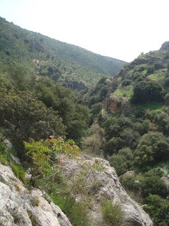
By 7.45 we headed out of Ussfiya down Wadi Chik. (We were glad to get out of Ussfiya in one piece since there'd been rioting there during the week, but if you want more information about that, read the papers.) The path was wide and easy, the slope a gentle downhill, the birds were chirping and the weather was still cool and pleasant. Other than the above mentioned rubbish, what more could the 4 intrepid shvillers want? We were walking quickly through light pine forest and alternately thick, dark natural oak forest. Here and there the forest would open up and we'd marvel at the Carmel mountains all around us.
Occasionally the marked shvil yisrael route would divert unexpectedly from what appeared to be the main wide path but this was welcomed as it led us down a smaller, less travelled path.
We knew most of today's route was downhill, with a net drop of about 500 metres, but there was one major uphill to be negotiated, Mt Shokef. And so  after an hour or so of walking we rounded a bend and sure enough the path started to incline. And climb it did. This was a mountain, not a hill. So we just put our heads down, huffed and puffed, and forged ahead. Big mistake.
We always new that at some point we were going to get lost. Not just miss a sign and backtrack a few minutes but totally and wholly lost. It was always going to happen. . Eventually our luck was going to run out and we would miss a turn or a marking and end up not knowing where we were or how far we'd gone in the wrong direction. That's the predicament we were in now. We had been so intent on just getting to the top that each one of us neglected to keep a look out for a route marking. By the time we realised that it had been a long time since we'd seen a marking we didn't know how far we'd gone since we missed it.  On the assumption we were on the wrong mountain, it meant  we had to retreat off this mountain, backtrack , find and climb Mt Shokef, the correct mountain. We found some shade, took out the guide book which has detailed topographical maps and hoped that we could get our bearings. When that failed, Yoni turned to the GPS in his cell phone in the hope that it would say "you are on top of Mt. Shokef". All it told us was that we were fucking idiots and were 6 km from the Carmel Mountain Spa & Retreat which under the circumstances was about as helpful as a council bureaucrat on lunch break. We all had that dreadful hollow knot in our stomachs that came from the certainty that we'd waisted a few hundred thousand kilojoules of precious energy and we had no idea where we were. Energy that wasgoing to have to be expenedd again if and when we eventually found the right path.
 Before we started to backtrack I volunteered to climb  on just a bit further and reconnoitre the area ahead,  in case a miracle occurs and I stumble on to a trail marking. Off I waddled and after a couple of hundred metres it sort of levelled out and after another bend or two a path (of course,not the correct path) continued on a plateau-like course. Not having a clue of what to make of this information I returned to the group of stunned mullets like one of the spies that had entered into biblical Israel in order to report back to Moses and the tribal elders. There were 2 pieces of semi sensible information. One is  the path ahead, the one we knew to be the wrong one, was flat-ish. Certainly not the steep incline that we would have  to climb if we backtracked. Two, the path headed west, the direction  we had to go. So on the basis of these two pieces of not ironclad logic we decided to push on rather than take  the far more logical yet unpleasant option of going back. The spring that had previously been in our step was now gone, replaced by the plod of not having a clue where this was going to take us. And so on we plodded for about 15 minutes until suddenly and for no apparent reason, a small side path joined the path we were on. Lo and behold, this side path had the familiar white, blue and orange markings painted on a rock, as did another rock on the path we were walking on about 20 metres ahead. It appears that we'd been on Mt Shokef the whole time and had simply missed the turn off that would have had us climb directly up the mountain. Instead we arrived to this point on a more circuitous and stressful route. Once again a combination of dumb luck and the gods looking out for us saved us from what could have been a much worse situation. But we really are pushing our luck.
I'm not trying to blame Mr. Shvill painter for us getting lost but I must comment that he was largely out to lunch when he had to paint the markings on today's leg. There were many place where there simply was no marking, the marking was in an illogical and unhelpful place or even directed us in one direction when we found 50 metres down the path that it wasn't exactly the right way. Subsequently we spent more time than usual walking around in circles, looking for trail markings and that doesn't include the time when we didn't even bother looking for a trail sign because we knew we were lost.
Not long after we rejoined the correct path and  got to the top of Mt. Shokef the trail came into a small clearing that was occupied by a makeshift army camp. A large camouflage tent, a drinking-water tank on
wheels and we probably would have found some other army stuff if we'd bothered to look. The fact  we didn't really pay it much attention and weren't really so surprised  to see a temporary army base in the middle of no-where says lots about how commonplace and ordinary the military is in Israel. I'm not sure that such a scene would have been treated with such nonchalant disregard in Australia, the U.S or any other western country.
Now that we'd climbed Mt.Shokef we had to descend it. Basically from here we descended 400 metres over about 7 km of walking. I know we spend lots of time dodging serious uphills by either driving to the top (Mt tabor) or reversing the direction of the day's walk. I also know that climbing what we did today wouldn't have been any fun what so ever. But anyone who has done mountain walking can vouch that sometimes steep downhills are not much easier than the uphills. Parts of the path were broad and leafy or along a wide safe ledge above the winding valley below and the slope was barely noticed. In other parts the way was narrow, steep and rocky. If it didn't tax our cardo-vascular system it made  our knees feel all of their fifty years. And then there were sections that the "path" was a drop down a cliff-face or a crevice. When your 21 and nimble you wouldn't give it a second thought. When your'e 50, far less nimble and much broader (and that's putting it gently), getting down these sections takes second, third and fourth thoughts. An eagle hovering above would have lost all control of its flight from laughing so hard, seeing the 4 of us trying to manoeuvre down these rock faces.
In a previous blog I proposed a theory that girls walking the shvill always do it in groups of three. Not Quite sure why, but today the theory was certainly reconfirmed. I think we saw 4 groups of girls walking the shvil and they were all 3-somes, except one group who were walking as a pair. We asked them half jokingly where the third one was and they answered perfectly seriously that she'd taken a day off and was rejoining them tomorrow
As we headed  further west the Mediterranean Sea loomed closer.  We saw the sea for the first time, from a distance, during our previous leg. I'm a bit ho hum about it but Yoni and Garry, the seafarers, were quite excited. If we would very generously describe the Galil as the whole area north of Haifa then any way you look at it, by now we were truly out of the Galil.
I think I can safely say it was the weirdest walking day we've had. We thought we'd goten really badly lost, but didn't. I rolled my ankle but continued on like the brave trooper I am. Garry, who is usually the fittest of us looked a bit like a zombie after having had only two hours sleep due to guard duty on Kedarim. Then, to make matters worse Yoni and Garry somehow got separated from Tracey and I even though they were only 10 metres behind us. I rang Garry to check out where they were and they had taken a different path. Since they had already moved on and didn't want to backtrack, we agreed that we would meet in the carpark at ma'aat eztbah national park that both of us could see about 300 metres below. The car park was about 11 km after we started and would have been the end point if we'd decided to do the shorter route. From here we were to head south another 8 km over hopefully easier terrain.
 Tracey and I continued on the marked shvil route which was quite circuotous as it curled around the mountain. The path dropped sharply along slippery loose stones until  eventualy it came down into a dry creek bed which led Tracey and I to the carpark. Yoni and Garry were already there, leaving us jealious that they'd taken the shortcut. Big mistake. It appears the the path they'd taken ended not long after I'd spoken to them and they descended the last part of the mountain through bush and straight down the mountain face. Yoni had taken a fall and hurt his shoulder and Garry, who started the day exhausted was now catatonic. But we had another 8 km to go to get to the end and back to the car. Well in theory, at least. In practice we decided that Tracey and I would walk  300 metres down to the main road, the old Haifa -Tel Aviv road, hitch hike or catch a bus 7 km down the road , walk inland 300 metres and pick up the awaiting car. Whilst no one stopped for two dusty, sweaty vagabonds, the egged bus driver had no such choice and dropped these 2 strange passengers off 7 km further south from where they got on. We got back to the car and drove back to pick Garry and Yoni up. A somewhat ignoble finish to a strange day's walk.

Saturday, 20 March 2010

15th day (The Big Cheat)


If these shvil blogs are ever to get turned into a book, then there are some names for the book that spring to mind. Something like " Shvil Yisrael for the 50 Year Old - Are we over the hill, (yet)?" Or since we change the walking direction depending on the uphill or downhill grade of the day's walk, perhaps "The Downhill Walkers Guide to Shvil Yisrael" is appropriate? There would have to be an appendix, or an altogether second volume that would be named "Cheating the Shvil" "Shvil Yisrael Through a Car Window" or "The Drivers Guide to Shvill Yisrael" . The possibilities are endless. No series would be complete without the obligatory restaurant guide "The Shvil on a Full Stomach", "The Eating Guide to Shvil Yisrael" or simply "Abu Shvil". If anybody out there in cyberworld has any additional book ideas or name suggestions, then just send them in, via the comment part of the site, e-mail or facebook. Any way you want to look at it, today's leg would get pretty good coverage in all the books and for good reason.
We'd agreed to start early in order to exploit the day as much as possible and not be pressured about getting back to the real world of family and shabbat dinners too late. I picked Garry up in Carmiel at 6.15 so we could get to Allonim junction by 7.00. We were the first ones there and headed straight for the Arcaffe. Tracey rolled in a few minutes later and Yoni a minute after that. There's something very civilised, very right, about starting our day's walk with a really good double machiatto. We miss our Kedarim Segafreddo.
From there it was on to the end point to drop a car off outside of Tivon, then on to the centre point at kibbutz Yagur where we would drop off a second car and up Mount Carmel to the Druze village of Ussfiya to start the days proceedings. Centre point? Drop off in the middle? Have I made a mistake describing today's route? No,no, no. No mistake. As previously mentioned ad nausium, we don't like walking on road. Even if the road is part of a kibbutz or the same road leads through a slightly run down agricultural hassidic settlement. So by un-unanimous democratic decision we arranged to come down Mt. Carmel and pick up a left  car in the carpark of kibbutz Yagur . We would then drive through to the edge of Kfar Hassidim, where we would continue to walk to the end. This is no skimming off a few clicks of pointless road walking at the beginning or end. This is full-on wanton cheating. No other way to call it. But hey, I'm a democrat and once again, 3-1 is a clear decision. So today's route would be divided into 3 distinct sections. The first walking down Mt. Carmel via Nachal HaMa'apilim. The second driving from Yagur to Kfar Hassidim. The third walking through very different topography from the mountain descent, between Kfar Hassidim to Tivon.
If you check your atlas, or know the places that I've named, you'll notice that we've changed the direction for this walk. Absolute, unquestionable unanimous decision here. Down Mt. Carmel is much more enjoyable than up Mt. Carmel.
So there we were, looking for the starting point for today's jaunt in the middle of Ussfiya. Eventually we spotted the tell-tale white orange and blue markings along the main road of the village and found a place to park in some restaurant's carpark. We crossed the road and started off through the suburbs of the village.  No sooner had we started walking when the complaining started with it.

Tracey and Yoni competed who could whine louder as to why we hadn't  driven through this part rather than walk, God forbid, along this pleasant little side road. I rolled my eyes and tried to suffer them silently. Eventually the markings pointed us down a dirt track, still wide enough to take a car down if we'd really wanted to, but the cacophony of complaints was eventually replaced by the far more pleasant chirping of the birds. As we got deeper into the pine forest the road narrowed and we were all happy.
One of the first subjects of conversation was the continuation from the previous walk concerning the pisstool, our female outdoor urinary aid. Cousin Linda, who worked for many years in the outdoor equipment business , politely pointed out to me that it already exists. Bummer. Doesn't have as great a product name as pisstool, though.  But not to worry. Tracey and Yoni both got whacked in the face by a branch that flicked back, prompting us to try to invent a branch sensor that might be part of a hat that would warn the wearer that he/she was going to get imminently flicked by the branch in front. We don't have a name yet or a clear product design but we'll work on it next time. Or the time after that. We've still got a good few legs ahead of us before we hit Eilat. In the mean time if anyone has any ideas, bring 'em on.


The forest quite quickly changed from planted pine to natural oak and grew progressively darker. The old natural forest was overgrown and allowed in only mottled light. To think that this gem is only 10 minutes from Haifa, Israel's 3rd largest city. After an hour or so of quiet solitary walking the peace was broken by the unmistakeable sounds of school children. Not too raucous, as many Israeli school groups can be, but still, relative to the birds, an unwanted intrusion. Yoni and Garry laugh at how I occasionally bump into people on the trail that I know. And it happened again. Amongst this group from an Anthroposophic boarding school that takes in kids from troubled backgrounds were 2 young kids, Nikko and Sergei, who come on weekends to my neighbours since their own families can't take them. I don't know who was more surprised, them or me, but it was one of those numerous shvil moments when the unexpected happens. Not far after we passed them we stopped for our regular cup of herbal tea and chocolate croissant, but couldn't fully relax for fear of being overtaken by the rabble of school kids. They really seemed to be well behaved when we passed them but that doesn't mean that we wanted to share this narrow, shaded mountain path with them. And so passed the first part of our morning, walking down a gradual to moderate slope through thick old-growth forest until we came out quite suddenly into the car park at Yagur. I had been led to believe that the descent down Nachal HaMa'apilim was a steep one, even treacherous at times. No such thing. It was a lovely little stroll that barely caused us to break a sweat. Maybe it's all just relative. The previous walk, down Nachal Amud, was long and had about an hour and a half of hard up and down rock climbing. The three of us each suffered for the few days afterwards from stiff muscles, especially thighs, not wanting to tell each other for fear of being wimps. It wasn't till we met once again for this shvil section that we realised that all three of us suffered the same stiffness. No such risk after descending this mountain though.


 I'm not going to describe the drive to the next drop off point, other than Kfar Hassidim didn't look particularly charming but still might have been interesting to walk through. I wouldn't know.
Upon getting out of Tracey's car we were reminded immediately that this was an agricultural settlement, hassidic or not. The smell of hassidic dairies is no holier than any kibbutz dairy. That mix of stale cow urine with boggy cow shit is a smell that wafts through many kibbutzim, moshavim and here in Kfar Hassidim. We were happy when we finally got out of olfactory range.
We saw a number of strange things along the route today. Truth is, we often encounter something strange or unexpected and that's one of the beauties of the trail. So today we had a telephone handset hanging from an electric high tension wire in Ussfiya. Gives new meaning to the phrase "I was left hanging on the telephone". Then we had an intact toilet bowl in the middle of no-where. Poor Tracey copped a few jokes from her male companions about for once not having to squat or use the pisstool in nature. And then we had 2 shvillers and a dog. Yes, they were walking the entire shvil all in one go, the large horse-dog being laden with a girdle, full of overstuffed pockets . I'm not convinced that the dog-sherpa union would have approved but it didn't seem to be complaining.

The hardest part of today's walk was the steep hill we had to climb not long after we left Kfar Hassidim. Even though it was quite steep,  it was still only a hill. 20 minutes of huffing and puffing and we were at the top. And the views from the top made all the puffing and panting worthwhile. We were basically looking back from above, over the distance that we'd covered, either by foot or motor. The Carmel mountains, Zvulun Valley, Haifa, the smoke stacks of the bay oil refineries, and the sea. Now if I'm a canyon and cave man then Garry is a beach and sea man, so imagine Garry's joy of seeing the sea in the distance for the first time in a year of shvil walking. The Mediterranean has never really done it for me, what, after Bondi, the Great Barrier Reef or Wilson's Prom. Still, Garry is going to be one happy camper for the next year or so.
In the year and a month that we've been on the trail I've avoided self congratulation because, well, there's really been no reason. But now I will allow just a hint of it. When Garry set Haifa as our aim after the first year I thought he was being his usual over optimistic self, perhaps only half believing that we could really walk from Dan to Haifa. But after 13 months and 15 walks which involved quite a lot of manoeuvring and effort in regards to personal schedules, we saw Haifa and the sea from the top of this unnamed hill and we realised that we really, truly have done it. And yes, it felt good. Then the reality check kicked in after a brief discussion of our aims for the second year, then the third and the fourth and fifth through the desert to Eilat. We've still got a long way to go.

At the top of the hill we crossed a small field and spotted THE tree. One of the most memorable, impressive trees we've seen so far on the trail. .An enormous, lone oak tree that you just can't walk past without resting under it. So, drawn by it magic, we did just that. It's a hard life, but someone's gotta live it. Eventually we  pried ourselves away from the enchanted tree, carried on and soon passed a Bedouin encampment. A run down hut, an empty animal enclosure, bits of unused corrugated metal sheeting strewn over. Its a sight they we see reasonably often. These little outposts are not marked on any maps and are not inhabited all year round, but we've seen them dotted all over the north of Israel. It's a reassuring sign that the modern 21st century Israel still hasn't invaded every square inch of the country.
The descent was a bit gentler than the ascent which as I've said already, wasn't too hard. I would say,in fact, that gentle is the word that comes to mind when I think of today's route. The descent down Mt.Carmel was not overly troublesome. The countryside that we walked though from Kfar Hassidim comprised of easy, gentle hills. Now we were into the last section, a very slight uphill meadow, full of the obligatory spring wildflowers, different from the previous two walks due to the different geographical areas and changing seasons. Yoni commented that this walk was no less beautiful than Nachal Amud. It certainly isn't as breathtaking as Nachal Amud but I certainly understand his enthusiasm for today's deep forest, the views over Haifa Bay and now these final few kilometres which were pretty much a perfect end to a perfect days walk.
As we were driving back to Kfar Hassidim to pick up Tracey's car, she got a phone call from her daughter that there was water leaking through the roof of her house. It happens that life interrupts our best efforts to escape reality. So while Tracey had to quickly return home and try to find a plumber on a friday afternoon, we filled our faces in the decidedly un Abu Abu country restaurant called Karmei Zait (the Olive Groves) in Kfar Hassidim.


Friday, 5 March 2010

14th day (The Crown Jewel)

14th day, 6th leg (the crown jewel)


This is going to be a short blog for a long route.

I was going to name this entry "the missing link" given that we'd decided to skip past it in the summer so that we could come back and do it in a more appropriate season, like spring. In hindsight the decision was the correct one. Today's walk was so striking in so many different ways that it was like the most precious jewel in the collection, the crown jewel.
Essentially Nachal Amud takes lots of features of legs already walked and rolls them up into a 20 km edited highlights. In fact we probably could have saved ourselves 150 km of sweat and a year's full of Fridays and just have done Nachal Amud. But then we would have missed out on all the meals.
So, what did we have today? Let's see. Streams, brooks, a waterfall, a pool, springs and dirty brackish water. A varied array of forests, scrub, weeds, big trees, little trees, evergreen trees, deciduous trees. And wildflowers. Lots and lots and lots of wildflowers. Steep descents, gentle slopes, cliff ledges, scrambling up rocks, descending on our bums, hard walking, good paths and rock-hopping. I could cut and paste the best parts of other walks and end up with this amazing swathe of nature.


In most of the blogs till know I've roughly outlined the route with observations along the way. As I've already mentioned, today's walk compressed lots of what we'd seen already into one walk, so there's no need for me to describe the first part which was highmountain terrain (by Israel's standard at any rate) – see leg 4. Then there was water – see leg 3. And so on. As it is I fear that there's an element of repetition in the blogs, so I won't make that sin here. Anyhow, how many times in one piece can I say "beautiful" , "amazing" , stunning" and "Breathtaking"? I would wear out my thesaurus trying to find ways to describe the varied beauty of today's leg. And if there is one overwhelming observation from today's walk then it is indeed the variety. When you start at 700 metres above sea level and descend to 80 metres below sea level, then it's only natural that in the 20 kilometres of trail you get such a variety of views, terrain, flora and fauna.


Not only did we go back one last time to an area that we had otherwise finished, we were reminded that this area of Israel is relatively untouched in relation to the rest of our squashed up little country. More nature, less humans.  This is a wild, unkempt (but well and freshly marked) trail. There's no settlements, Jewish or Arab, above, below or in front. No dirt tracks that can accommodate buggies or 4*4's. There was no cheating here, no driving as far as we could and then begrudgingly getting out to walk. We saw very few other walkers. A day tripping couple here, some lost Russians there, but for most of the time it was just us and the din of birds chirping. Have I mentioned previously that we like our nature to ourselves? Well we got it today. We were out in nature with no human evidence other than a number of ruined bridges and mills that suggested that in a bye gone era this area had more human activity than today. A welcome regression.


And then there are the wildflowers. I know that in the previous blog I described the impressive array of wildflowers but I think I'm going to have to engage in some creative editing to the previous entry. It was a barren dessert compared to today. There were the vivid colors of the flowers in full bloom throughout the entire walk, sometimes at our feet and at other times like walking through a jungle, a multi-colored head high jungle of assorted flowers. It certainly gave justification to our skipping over this route and waiting to do it at the right time. This time. The perfect weather also added more justification, as if we needed it.


I guess after 35 years and endless hours spent talking about business, career advice, legal advice, advice to the government and to the Palestinians, children, the old days and lots, lots more the inane starts to filter through. How else could you explain the amount of time spent on continuing a subject that we started last time? It arose when Tracey made a comment about the inconvenience of having to deal with nature calling whilst walking through nature. How unfair it is that half the world's population can just stand there and go with the flow, so to speak, whilst the other half have to pull down pants, squat etc etc. I don't think I need to go into more details! So I came up with the idea of a travel penis, a device that can be easily, um, applied, and would save the need to squat. That was last walk. This time we continued to flesh out the idea. Garry, always the entrepreneur, came up with the name…the piss-tool. We may shape it to resemble a hand-gun, though the original and natural penis shape probably has ergonomical advantages .We're going to buy the rights to use the Charley's Angel emblem of 3 silhouetted women holding guns.
Perfect. Maybe the logo should be a water-pistol? In any case if anyone has a better name or marketing idea then send it in. If it's used the sender will receive a free product. At any rate it will go into the pantheon of inventions that I've thought up over the years. By the way, it's my idea and no-one who reads this is allowed to rip it off.

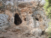
Nachal Amud is roughly divided into 2 sections, the upper and lower. The upper is, as you might expect, quite mountainous. The lower section is largely through a deep dry ravine with lots of caves etched into the walls. In some way it was a bit of a mistake doing the whole nachal in one go. By the time we got to the lower section we were starting to tire and get pressed for time. Nothing you can do about it. We took a day off work so we wouldn't have to worry about time and yet life outside the trail insisted on trying to interfere with our walking, whether it be Yael's swimming lesson that Yoni wanted to be at or my twins' bar-mitzvah lesson that I had to meet them at. So between fatigue and life we appreciated the lower section less and that's a pity. It doesn't have that wild mountain beauty of the upper section but it certainly has a lot to admire. If we'd had time and energy my two friends would have happily sent me exploring one of the caves while they rested, patiently tolerating my love for dank holes. It was not to be, however. In fact, in the end we were so tired, or so anxious to get back to our lives that we didn't even look for the local Abu Abu. And that's a pity as well.
Outdoors Blogs
Outdoors blogs